Global Distributors Wanted
1.Free Cloud Service Deployment
2.Free Technical Training
3.Exclusive Territory Protection

1.Free Cloud Service Deployment
2.Free Technical Training
3.Exclusive Territory Protection


Views: 215 Author: Aaron Publish Time: 2026-09-18 Origin: Site


Content Menu
● Wing and Walmart's Seven New Drone Delivery Markets
● Drone Delivery Is More Than an Aircraft and a Package
● From Individual Drone Flights to Connected Operations
● Understanding "One-Network Coverage"
● A Practical Example: Coordinated Response During Severe Weather
● The Operational Importance of Beyond-Visual-Line-of-Sight Flights
● Why Integrated Cloud Control Matters
● Building Urban Airspace 3+1 Delivery Systems
● How Enterprises Can Prepare for Drone Deployment
>> 1. Define the Core Application
>> 2. Assess the Operating Environment
>> 3. Build a Connected Data System
>> 4. Develop Contingency Procedures
>> 5. Measure Operational Performance
● The Future of Low-Altitude Logistics
● FAQ
>> 1. Which seven markets are included in the Wing and Walmart drone delivery expansion?
>> 2. Why are these new markets important for drone delivery?
>> 3. What does beyond-visual-line-of-sight mean?
>> 4. What is a cloud-control platform for drone operations?
>> 5. What does "one-network coverage" mean?
>> 6. What industries can use integrated drone systems?
>> 7. Why is ground-air coordination important?
Wing and Walmart's expansion into seven additional U.S. markets marks an important shift in commercial drone delivery. The announcement shows that low-altitude logistics is moving beyond limited pilots and toward larger, more connected operating networks that link drones, retail locations, digital platforms, ground resources, and urban infrastructure.
The seven planned markets are Memphis, New Orleans, Philadelphia, Phoenix, San Diego, the San Francisco Bay Area, and Salt Lake City. Together, they represent a diverse set of operating conditions, from dense urban corridors and coastal communities to hot-weather cities, logistics hubs, and mountain-adjacent service areas.
For retailers, municipalities, logistics providers, and technology companies, this expansion is not only about faster parcel delivery. It is about building a reliable operating system for low-altitude airspace—one that can coordinate aircraft, payloads, mission routes, weather data, ground teams, emergency resources, and real-time decision-making.
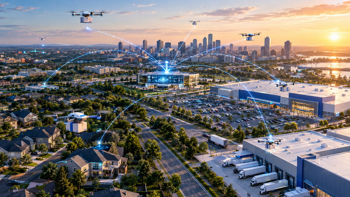
Wing and Walmart are preparing to bring drone delivery services to seven major U.S. metropolitan markets:
- Memphis, Tennessee
- New Orleans, Louisiana
- Philadelphia, Pennsylvania
- Phoenix, Arizona
- San Diego, California
- San Francisco Bay Area, California
- Salt Lake City, Utah
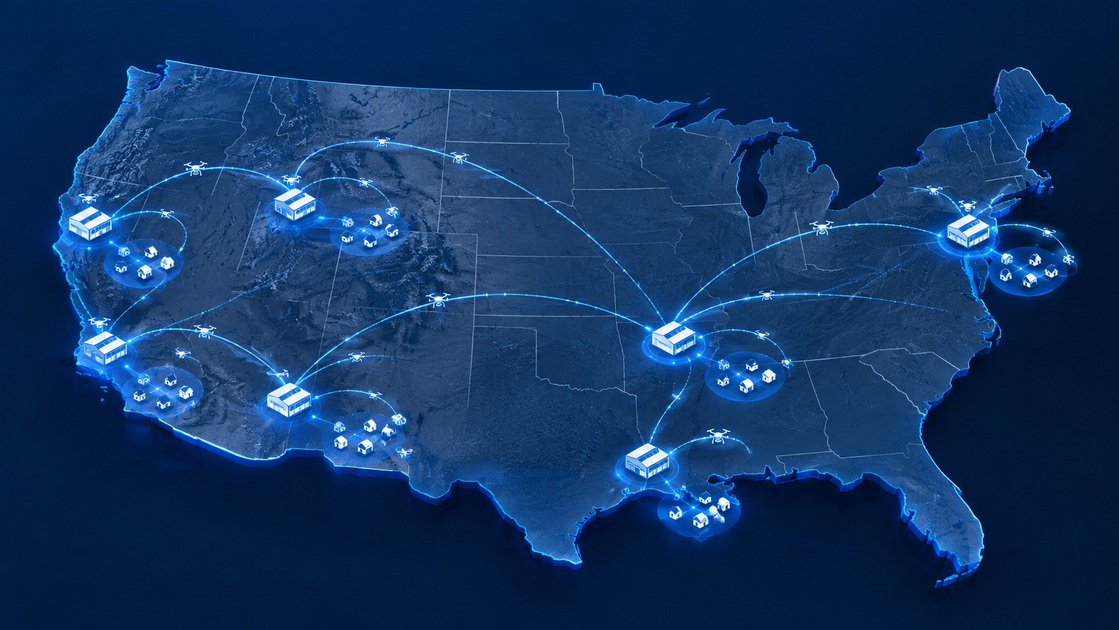
These locations are strategically important because they reflect the wide range of environments that a mature drone delivery network must serve. A delivery system that works in one suburban neighborhood may face very different operational requirements in a high-density city, a hot desert climate, a coastal region, or a logistics-heavy distribution market.
| Market | Operating environment | Key challenge for drone logistics |
|---|---|---|
| Memphis | Major freight and distribution hub | Coordinating drone service with high-volume fulfillment operations |
| New Orleans | Dense urban districts and variable weather | Maintaining reliable routes during rain, wind, and seasonal weather events |
| Philadelphia | Large Northeast metropolitan area | Managing airspace awareness and delivery precision near dense neighborhoods |
| Phoenix | Hot, spread-out urban environment | Maintaining aircraft and battery performance in high temperatures |
| San Diego | Coastal, suburban, and urban terrain | Designing flexible routes across diverse neighborhoods and airspace conditions |
| San Francisco Bay Area | Dense population and advanced technology ecosystem | Supporting multi-node operations while maintaining safety and efficiency |
| Salt Lake City | Mixed urban and mountain-adjacent terrain | Planning routes around terrain, elevation, and changing weather conditions |
The expansion demonstrates that commercial drone delivery is being tested across more realistic, complex, and geographically diverse service environments. Each market creates valuable operational experience for the broader low-altitude economy.
Many people first encounter drone delivery through a simple image: a small aircraft carrying a package from a store to a customer's home. The customer places an order, a drone departs from a retail location, and the package is lowered safely into a yard or designated delivery area.
That image is accurate, but incomplete.
Behind every successful drone delivery is a highly coordinated system. The aircraft must be available, inspected, charged, assigned to the correct order, routed through approved airspace, monitored during flight, and prepared to respond to changing conditions.
A scalable drone delivery network needs to manage:
- Aircraft health and maintenance status
- Battery capacity and charging cycles
- Payload weight and package verification
- Weather and wind conditions
- Flight-route planning
- Airspace restrictions
- Communication quality
- Delivery-zone safety
- Customer location accuracy
- Emergency procedures
- Mission history and operational data
The aircraft is the visible part of the service. The operating system behind it is what determines whether a drone delivery network can scale safely and consistently.
A drone can perform a single task very effectively. It can deliver a small item, inspect a building roof, survey a construction site, monitor a utility corridor, or provide aerial video during an emergency.
However, real cities and industrial sites do not operate through isolated tasks.
They operate through connected systems. A delivery zone may overlap with road networks, warehouses, residential communities, power infrastructure, public-safety routes, construction projects, and underground facilities. A weather event may affect delivery service, road access, emergency response, utility inspection, and public communication at the same time.
This is why the next stage of drone development will depend on coordinated operations across multiple environments.
Shenzhen Intelligent Drone Technology Co., Ltd. focuses on the deep integration and innovation of drone technology. The company provides full-stack application solutions for low-altitude, ground, and underground environments, helping organizations connect equipment, data, command centers, and field operations through one unified operational framework.
Rather than treating each drone mission as a separate activity, this model connects multiple assets into one intelligent network.
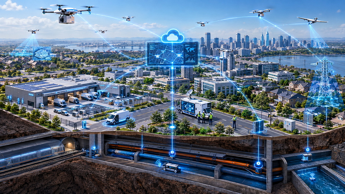
"One-network coverage" is a practical operating concept for organizations that need to manage more than one type of drone mission, device, or environment.
The goal is to break through the limitations of single-scenario solutions. Instead of operating delivery drones, inspection drones, ground vehicles, underground detection tools, and emergency-response equipment through separate platforms, organizations can connect these resources through a unified intelligent cloud-control system.
This approach supports seamless information sharing, coordinated command, and faster decision-making.
Low-altitude operations include aerial delivery, infrastructure inspection, environmental monitoring, public-safety reconnaissance, emergency-response flights, and site surveillance.
An intelligent flight platform can support:
- Real-time flight monitoring
- Route planning and route adjustment
- Fleet dispatch
- Equipment status monitoring
- Remote mission control
- Dynamic safety alerts
- Visual data collection
- Mission reporting
For drone delivery, this means that operators can monitor where each aircraft is, what it is carrying, how much battery capacity remains, and whether weather or airspace conditions require a mission update.
Ground operations include delivery stations, warehouses, charging equipment, mobile command centers, field teams, security units, emergency vehicles, and autonomous ground equipment.
A connected system can coordinate ground resources with low-altitude missions. For example, if a drone cannot complete a delivery because of sudden weather changes, the system can notify the operations center and support the transfer of priority orders to ground delivery resources.
This improves service continuity. It also reduces the risk of treating drone delivery as an isolated service that stops functioning whenever one part of the system changes.
Underground spaces are often difficult to inspect and manage. Tunnels, utility corridors, pipelines, drainage systems, subway infrastructure, and confined industrial spaces may have limited visibility, restricted access, communication challenges, and safety risks.
Underground-space detection can provide valuable information for cities, industrial sites, public utilities, and emergency-response organizations. When underground data is connected to a wider command-and-control system, teams can better understand how surface conditions, ground infrastructure, and low-altitude operations affect one another.
This three-layer model—air, ground, and underground—creates a more complete operational view.
Imagine a major storm moving through a city where drone delivery, infrastructure inspection, and emergency-response services are all active.

Without an integrated operational system, each team may receive different information at different times. Delivery operators may know that wind speeds are increasing. Emergency responders may receive reports of flooded roads. Utility teams may need to inspect damaged facilities. Ground delivery drivers may face traffic disruptions.
A unified cloud-control platform can bring these activities together.
1. The system receives updated weather and wind data.
2. Affected drone routes are automatically reviewed or paused.
3. Priority orders are flagged for alternative ground delivery.
4. Inspection drones are dispatched to assess roads, utility sites, or damaged structures.
5. Emergency teams receive aerial imagery and real-time situational information.
6. Underground detection resources can be assigned if drainage, tunnel, or utility infrastructure requires inspection.
7. Managers can review all mission data from a unified operational dashboard.
This type of coordination is especially important for smart-city management, public safety, urban logistics, and infrastructure resilience.
Beyond-visual-line-of-sight operations are central to the future of drone delivery. This term describes flights in which the remote operator cannot directly see the aircraft with the naked eye throughout the full mission.
For a small local demonstration, an operator may be able to keep a drone within visual range. But for large-scale commercial delivery across neighborhoods and cities, a network must support flights over greater distances and across multiple delivery zones.
Beyond-visual-line-of-sight capability allows drone systems to serve a larger area, but it also raises the operational standard.
A reliable system must support:
- Continuous communications between the aircraft and control platform
- Real-time location awareness
- Flight route management
- Obstacle and hazard awareness
- Emergency landing procedures
- Equipment health monitoring
- Accurate mission logging
- Data security and access control
- Clear operational responsibility
As drone networks become larger, the ability to monitor and manage these factors in real time becomes more valuable than aircraft speed alone.
A connected cloud-control platform is the operational center of an intelligent drone network. It can collect information from aircraft, cameras, sensors, ground devices, and command teams, then transform that information into a clear operating picture.
For a delivery company, this may mean knowing which aircraft is closest to a new order and whether it has enough battery capacity to complete the mission.
For an industrial operator, it may mean reviewing inspection imagery from several sites and identifying maintenance risks before they become expensive failures.
For an emergency-response organization, it may mean combining live aerial video, ground-team locations, weather conditions, road access, and underground infrastructure data during a fast-changing incident.
A strong cloud-control platform should provide several core capabilities:
| Capability | Operational value |
|---|---|
| Centralized monitoring | Provides a live overview of drones, missions, devices, and field resources |
| Intelligent dispatch | Assigns the right aircraft or resource to the right task |
| Dynamic route planning | Adjusts missions according to weather, airspace, traffic, or emergency conditions |
| Data collection | Captures visual, environmental, operational, and equipment data |
| Intelligent analysis | Identifies patterns, risks, and opportunities for improved performance |
| Multi-device management | Connects drones, ground equipment, sensors, and control stations |
| Historical reporting | Supports maintenance planning, performance improvement, and accountability |
| Emergency coordination | Helps teams respond quickly when normal operations are disrupted |
This is the foundation of full-stack drone applications.
Urban airspace delivery requires more than a drone taking off from a retail store. It requires a delivery model that coordinates low-altitude aircraft with supporting ground and operational resources.
The "3+1" delivery concept reflects the need for an integrated service structure. Instead of relying on one type of resource, the system can coordinate multiple delivery and support nodes to maintain flexibility in different environments.
A connected delivery network can include:
- Low-altitude delivery drones
- Retail or warehouse dispatch stations
- Ground delivery resources
- Mobile operational teams
- Charging and maintenance infrastructure
- Customer service systems
- Cloud-control and mission-management software
- Safety and emergency-response procedures
This structure becomes especially valuable when the network encounters real-world conditions such as weather changes, demand spikes, equipment maintenance, traffic disruptions, or public-safety incidents.
A full-stack system does not eliminate operational complexity. It makes that complexity visible, manageable, and measurable.
Organizations that want to adopt drone delivery, inspection, emergency-response, or underground-space detection services should begin with operational planning, not only equipment selection.
Start by identifying the business problem that drone technology should solve.
Possible applications include:
- Last-mile retail delivery
- Medical or urgent-item delivery
- Utility inspection
- Construction monitoring
- Industrial facility inspection
- Underground pipeline or tunnel detection
- Emergency reconnaissance
- Public-safety support
- Environmental monitoring
A clearly defined use case makes it easier to choose the right equipment, software, team structure, and performance indicators.
Every location has different conditions. Organizations should review terrain, weather, buildings, airspace restrictions, customer density, communication coverage, delivery routes, and emergency-access requirements.
The quality of this assessment directly affects the safety and efficiency of future operations.
Equipment produces data, but data creates value only when it is organized and available to the right people.
A connected platform should allow managers to review mission records, equipment conditions, inspection findings, route efficiency, maintenance needs, and safety events from one place.
Drone operations should include clear procedures for unexpected situations.
These may include:
- Sudden weather changes
- Low battery warnings
- Communication interruptions
- Restricted-airspace alerts
- Delivery-zone obstacles
- Equipment malfunctions
- Emergency landings
- Customer-service issues
- Public-safety events
A well-prepared operation can respond faster and reduce unnecessary service interruptions.
Drone deployment should be evaluated through measurable outcomes, not only visual demonstrations.
Useful performance indicators include:
- Mission completion rate
- Average delivery time
- Inspection coverage
- Response time
- Battery utilization
- Equipment availability
- Safety-event frequency
- Maintenance trends
- Route efficiency
- Resource utilization
- Customer satisfaction
These metrics help organizations understand whether drone technology is generating practical value.
The expansion of drone delivery into more U.S. markets reflects a broader transition in the industry. Drones are becoming part of a larger low-altitude economy that includes logistics, public safety, infrastructure management, intelligent inspection, environmental monitoring, and emergency response.
The future will not be defined only by how quickly a drone can carry a package. It will be defined by whether organizations can safely coordinate large numbers of aircraft, devices, people, data sources, and operating scenarios.
For this reason, the most valuable drone solutions will combine aircraft capability with intelligent operations.
Shenzhen Intelligent Drone Technology Co., Ltd. is committed to transforming advanced drone technology into practical productivity. Through independently developed intelligent flight platforms, dynamic perception, precise data collection, and intelligent analysis, SIDT supports full-stack applications across low-altitude, ground, and underground environments.
From intelligent inspection and underground-space detection to urban airspace 3+1 delivery and ground-air coordinated emergency response, the objective is to help customers build connected, efficient, and resilient operations.
The next stage of drone development is not simply about deploying more aircraft. It is about creating one intelligent network where every mission, device, data point, and resource can work together.
The planned markets are Memphis, New Orleans, Philadelphia, Phoenix, San Diego, the San Francisco Bay Area, and Salt Lake City.
The seven markets include different climate conditions, population densities, urban structures, logistics environments, and terrain types. This gives drone operators experience in a wider range of real operating conditions.
Beyond-visual-line-of-sight means that a drone is operated outside the direct visual range of the remote pilot. This capability is important for larger delivery areas, but it requires advanced monitoring, communications, safety systems, and operational procedures.
A cloud-control platform is a centralized digital system used to monitor drones, assign missions, manage fleets, collect data, analyze performance, coordinate resources, and respond to changing operating conditions.
"One-network coverage" means connecting low-altitude, ground, and underground equipment and operational resources through one coordinated platform. It helps organizations manage multiple tasks and locations without creating disconnected information systems.
Integrated drone systems can support retail delivery, logistics, industrial inspection, utilities, infrastructure management, emergency response, public safety, construction, environmental monitoring, and underground-space detection.
Ground-air coordination allows drones, field teams, vehicles, warehouses, command centers, and emergency resources to share information and work together. This improves mission efficiency, service continuity, and decision-making.
1. Wing. "." Information on the seven planned markets, delivery operations, Wing drone performance, and network expansion plans.
2. Federal Aviation Administration. "." Information on commercial package delivery, beyond-visual-line-of-sight operations, and Part 135 certification requirements.
3. Federal Aviation Administration. "." Information on regulations related to commercial unmanned aircraft operations and property transportation.
4. Federal Aviation Administration. "." Information on the integration of drones into the national airspace, public safety, data links, and operational testing.
5. U.S. Department of Transportation Office of Inspector General. "." Information on regulatory progress, operational safety considerations, and the challenges of integrating beyond-visual-line-of-sight drone operations.
6. Supply Chain Dive. "." Information on Wing and Walmart's longer-term network-development goals.


