Global Distributors Wanted
1.Free Cloud Service Deployment
2.Free Technical Training
3.Exclusive Territory Protection

1.Free Cloud Service Deployment
2.Free Technical Training
3.Exclusive Territory Protection


Views: 211 Author: Aaron Publish Time: 2026-09-14 Origin: Site


Content Menu
● Why Intelligent Drone Solutions Need Full-Stack Integration
● SIDT One-Network Coverage for Multi-Space Operations
● Intelligent Flight Platform for Smarter Drone Operations
>> Key Intelligent Flight Capabilities
● Dynamic Perception and Precision Data Collection
● Intelligent Analysis Turns Data Into Action
● Urban Airspace 3+1 Delivery for Connected Logistics
● Intelligent Inspection for Safer Asset Management
>> A Closed-Loop Inspection Process
● Underground Space Detection and Assessment
● Ground-Air Coordinated Emergency Response
>> A Typical Ground-Air Response Workflow
● How Organizations Can Evaluate Intelligent Drone Solutions
● Building Smarter Low-Altitude Operations with SIDT
>> 1. What are intelligent drone solutions?
>> 2. What does SIDT mean by one-network coverage?
>> 3. How can drones improve industrial inspection?
>> 4. What is urban airspace 3+1 delivery?
>> 5. How does ground-air coordinated emergency response work?
>> 6. Can SIDT solutions support underground environments?
>> 7. Why is a unified cloud control platform important?
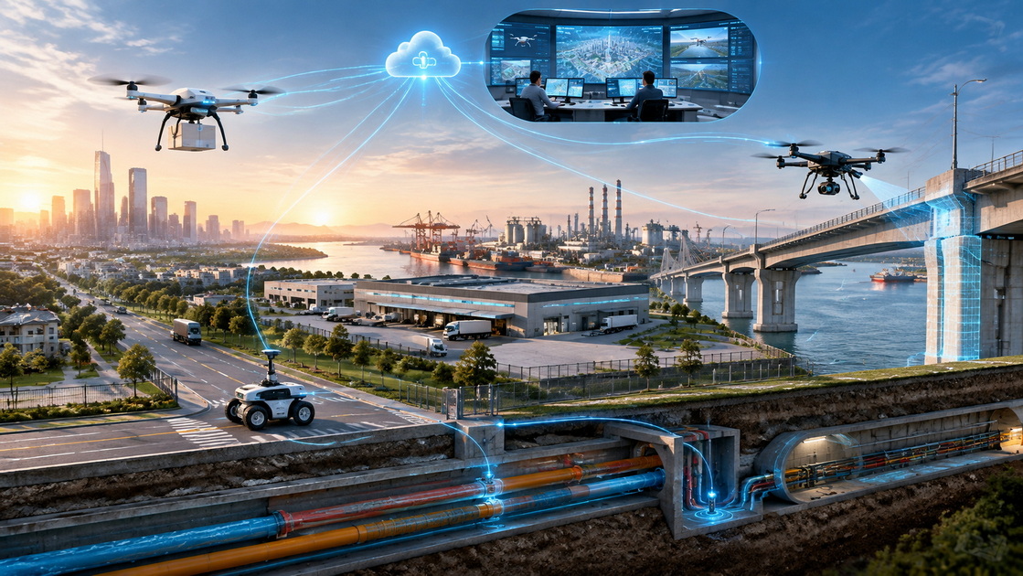
Low-altitude airspace is becoming an important part of modern urban infrastructure, industrial operations, and public-service systems. However, effective drone deployment requires more than a single aircraft, a camera, and a remote pilot. It requires a connected operating model that links airborne devices, ground resources, underground sensing, data platforms, field teams, and decision-makers.
Shenzhen Intelligent Drone Technology Co., Ltd. (SIDT) focuses on the deep integration and innovation of drone technology. The company provides comprehensive, full-stack application solutions for low-altitude, ground, and underground environments.
Through an independently developed intelligent flight platform, SIDT integrates dynamic perception, precise data collection, and intelligent analysis. These capabilities support practical applications including intelligent inspection, underground space detection, urban airspace 3+1 delivery, and ground-air coordinated emergency response.
SIDT's goal is straightforward: transform advanced drone technology into core operational productivity and create measurable value for customers in complex real-world environments.
Commercial drone technology has developed rapidly. Drones are now used for inspection, mapping, logistics, security, emergency operations, construction management, environmental monitoring, and infrastructure maintenance.
Yet many organizations still operate drones in isolated scenarios.
A drone may collect inspection images without connecting the findings to the maintenance team. A delivery aircraft may complete a route without sharing real-time information with logistics operators. An emergency-response unit may launch a drone quickly but lack a unified view of the incident across air and ground resources.
These disconnected workflows can limit the true value of drone systems.
SIDT addresses this challenge through a full-stack approach. Instead of treating each aircraft, sensor, vehicle, and platform as a separate tool, SIDT connects them into a coordinated operational network.
This network can support:
- Unified command and dispatch across different equipment types
- Real-time device monitoring across multiple locations
- Dynamic data collection from air, ground, and underground environments
- Intelligent analysis that turns raw information into operational insights
- Cross-team collaboration between command centers, field workers, technical teams, and management personnel
- Traceable task records for inspection, delivery, emergency response, and follow-up work
The objective is not simply to deploy more drones. It is to build a more reliable system for collecting information, coordinating resources, and making faster decisions.
"One-network coverage" is a defining feature of SIDT's intelligent drone solution framework.
Cities, industrial parks, logistics centers, and public infrastructure networks operate across multiple physical layers. Low-altitude airspace, roads, buildings, utility corridors, underground facilities, warehouses, and emergency routes are closely connected. A single drone or a single software tool cannot provide a complete operational picture.

SIDT breaks through the limitations of single-scenario drone applications by developing connected solutions for different spaces and multiple operational nodes.
| Operational Area | Typical Challenge | SIDT Solution Direction |
|---|---|---|
| Low-altitude airspace | Route planning, flight coordination, delivery efficiency | Intelligent flight management and centralized mission control |
| Ground environment | Equipment dispatch, field collaboration, incident response | Ground-air coordination and real-time task management |
| Underground space | Limited visibility, difficult access, safety uncertainty | Integrated sensing, detection workflows, and data analysis |
| Industrial facilities | Asset inspection, maintenance delays, safety risks | Automated inspection routes and closed-loop maintenance records |
| Urban logistics networks | Fragmented delivery processes and limited real-time visibility | Coordinated air-ground delivery management and cloud dispatch |
Through a unified intelligent cloud control platform, SIDT supports one-stop command, dispatch, monitoring, and management of equipment operating in different environments.
This creates a more seamless connection between devices, data, and people.
For complex scenarios such as urban airspace 3+1 delivery and ground-air coordinated emergency response, one-network coverage enables organizations to bring multiple resources together under a shared operational framework.
An intelligent flight platform is the foundation of a scalable drone operation.
In a basic drone program, each mission may depend heavily on manual planning and direct pilot control. This can work for occasional tasks, but it becomes difficult to manage when an organization needs repeated inspection, regular delivery routes, multi-site patrols, or rapid emergency deployment.
SIDT's intelligent flight platform supports more structured drone operations by connecting mission planning, aircraft monitoring, data capture, and operational management.
- Mission planning: Define routes, task areas, inspection points, delivery locations, and operational schedules.
- Flight monitoring: Track aircraft position, mission progress, equipment status, and field conditions.
- Multi-device coordination: Support collaboration between drones, ground equipment, command centers, and field teams.
- Dynamic task adjustment: Modify missions based on incidents, changing priorities, weather conditions, or site requirements.
- Operational records: Retain task data, flight records, inspection information, and response histories for future review.
- Centralized management: Give authorized teams a shared platform for equipment oversight and task coordination.
These functions help reduce fragmented workflows and improve operational consistency.
Drone applications create value when they provide useful, reliable, and timely information.
For many organizations, the central question is not whether a drone can fly. The more important question is whether the drone system can identify meaningful conditions, capture accurate data, and help the right people act on the results.
SIDT integrates dynamic perception and precision data collection into its full-stack solution model.
Different projects may require different combinations of information, including visible-light images, high-definition video, thermal observations, location data, environmental information, equipment status, mapping outputs, and on-site sensor readings.
This capability can support a broad range of use cases:
- Infrastructure inspection
- Industrial-facility monitoring
- Construction-site management
- Utility corridor assessment
- Security patrols
- Perimeter observation
- Environmental monitoring
- Underground-space evaluation
- Emergency-scene reconnaissance
- Low-altitude logistics coordination
The value of drone data does not come from collecting the largest possible volume of images or videos. It comes from collecting the right information at the right time, organizing it clearly, and linking it to a practical action.
For example, an industrial inspection mission can identify a potential issue at a specific location. The system can then help operators classify the issue, assign a follow-up task, verify maintenance progress, and retain a complete record.
This creates a more disciplined process from detection to resolution.
In many drone programs, data collection is only the first step. The real challenge begins after the drone lands.
Teams may have hundreds of photographs, hours of video, sensor readings, flight records, and location information. Without a clear analysis workflow, these materials can become difficult to review, compare, prioritize, and use.
SIDT's intelligent analysis capabilities are designed to shorten the distance between field observation and operational decision.
A well-designed workflow should help an organization answer several important questions:
1. What has been detected?
2. Where is the issue located?
3. How serious is the condition?
4. Which team needs to respond?
5. What action should be taken next?
6. How should the outcome be recorded and reviewed?
For infrastructure operators, intelligent analysis can help identify areas that require further inspection or maintenance attention.
For logistics operators, it can support route monitoring, task visibility, and service coordination.
For emergency teams, it can provide a clearer picture of the incident scene and help command personnel allocate resources more effectively.
The purpose is to make drone-generated information easier to understand, easier to share, and more useful in real operational decisions.
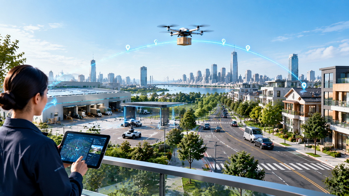
Urban drone delivery is evolving from an experimental service into a broader low-altitude logistics opportunity.
Recent commercial deployment activity shows that drone delivery can support fast, local transportation of small goods when the service is integrated with reliable operations, airspace coordination, fulfillment systems, and customer communication.
However, successful delivery systems require more than a drone flying from one point to another.
A scalable model must coordinate local fulfillment, loading, route management, airspace awareness, equipment status, delivery confirmation, exception handling, and safety processes.
SIDT's urban airspace 3+1 delivery model is designed as a connected system rather than an isolated aerial delivery service.
| System Layer | Core Function |
|---|---|
| Low-altitude air network | Supports drone routes, flight operations, and aerial transport |
| Ground logistics network | Connects fulfillment points, loading areas, delivery locations, and service resources |
| Digital intelligence network | Supports dispatch, monitoring, data sharing, route status, and operational analysis |
| Command and safety center | Provides centralized management, exception handling, resource coordination, and response support |
This model can support time-sensitive delivery scenarios such as:
- Local consumer goods
- Documents and lightweight parcels
- Emergency maintenance components
- Campus and industrial-park supplies
- Medical-support logistics where permitted
- Warehouse-to-site parts delivery
- Specialized equipment transport for field operations
The most important factor is not speed alone. It is reliable, visible, and manageable delivery performance.
A connected delivery model helps operators understand where aircraft are, what tasks are in progress, whether a route has changed, and how to respond if a delivery requires attention.
Intelligent inspection is one of the most valuable uses of drone technology because it can improve visibility while reducing the need for personnel to enter difficult, elevated, remote, or potentially hazardous areas.
Traditional inspection methods can be time-consuming. They may require scaffolding, shutdowns, rope access, manual documentation, or repeated site visits. These processes can increase cost, delay maintenance decisions, and expose personnel to unnecessary risk.
SIDT's intelligent inspection solutions are designed to help organizations move from occasional observation to structured asset-management workflows.
1. Define inspection targets
Identify the asset, facility, route, structure, equipment group, or operational area that requires inspection.
2. Develop repeatable mission routes
Establish drone flight paths, observation angles, sensor requirements, inspection frequency, and site-specific procedures.
3. Collect precise field data
Capture images, video, thermal information, location data, and other relevant observations.
4. Organize and analyze findings
Classify the information by asset location, issue type, urgency, severity, and required response.
5. Assign follow-up work
Share the results with maintenance, engineering, security, operations, or management personnel.
6. Record outcomes
Maintain a traceable history of the detected condition, corrective action, verification result, and future inspection requirement.
This approach can be applied to industrial parks, utility infrastructure, construction sites, transportation corridors, energy assets, public facilities, warehouses, and large commercial properties.
The result is a clearer maintenance process supported by better information.
Underground environments are often among the most challenging spaces to inspect and manage.
Tunnels, utility corridors, basements, pipelines, enclosed industrial areas, drainage-adjacent spaces, and underground facilities can present limited visibility, difficult access, signal constraints, and potential safety risks.
Before personnel enter a confined or uncertain environment, decision-makers need better situational awareness.
SIDT extends its solution framework beyond low-altitude flight by integrating aerial context, ground-based equipment, sensing technologies, data analysis, and centralized management.
This approach can support underground-space detection and assessment for:
- Municipal utility tunnels
- Underground corridors
- Industrial enclosed spaces
- Large basement facilities
- Underground parking and infrastructure areas
- Mine-related environments
- Disaster-affected subsurface locations
- Drainage, pipeline, and utility-adjacent inspection zones
A strong underground detection workflow begins with the wider site context. Teams can evaluate surface conditions, identify priority areas, collect targeted data, and guide field personnel with more precise information.
This helps reduce uncertainty and enables more informed resource allocation.
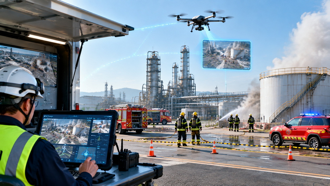
Emergency situations require fast decisions, accurate information, and effective coordination.
Drones can provide rapid aerial awareness of an incident scene. They can help identify access routes, observe affected areas, monitor changing conditions, support search operations, and provide visual updates to command personnel.
Ground teams provide physical intervention, rescue, site control, traffic management, equipment support, and direct communication with affected people.
The strongest emergency-response model connects these two capabilities.
SIDT's ground-air coordinated emergency-response solution is designed to support a shared operational picture between aerial devices, ground resources, command personnel, and connected field teams.
- An incident alert enters the command platform.
- A drone is assigned for rapid scene assessment.
- Live aerial information provides early visibility of the affected area.
- Command teams evaluate access routes, risk zones, and response priorities.
- Ground resources are dispatched based on verified information.
- Teams receive updates as the situation develops.
- Incident records are retained for reporting, review, and training.
This model can be useful for fire response, public-safety operations, infrastructure incidents, natural-disaster assessment, industrial emergencies, traffic incidents, search operations, and large-site security events.
Technology should reduce confusion during an emergency. It should help teams share the same information, coordinate faster, and focus resources where they are needed most.
When evaluating an intelligent drone solution provider, organizations should consider more than aircraft specifications.
Payload, flight endurance, camera quality, and navigation capabilities are important. However, these factors alone do not determine whether a solution can support long-term operations.
A practical evaluation should include the following questions:
- Can the solution support low-altitude, ground, and underground environments?
- Does the platform provide centralized command, dispatch, and device management?
- Can collected data be transformed into reports, alerts, inspection findings, and follow-up tasks?
- Is the solution suitable for one site today and multiple sites in the future?
- Can it connect with existing management systems, logistics workflows, maintenance platforms, or emergency command processes?
- Does the provider understand application scenarios as well as hardware?
- Are safety procedures, operator requirements, and local operating conditions considered during planning?
- Can multiple teams collaborate through one shared operational platform?
The strongest intelligent drone solutions connect devices, data, people, and decisions.
They help organizations move from isolated drone flights to coordinated operational capability.
The future of low-altitude operations will depend on connected systems.
Drone technology can support delivery, inspection, underground assessment, emergency response, and many other complex applications. But the greatest value comes when these capabilities work together through a unified network and a shared management platform.
SIDT provides full-stack intelligent drone solutions for organizations that need greater visibility, stronger coordination, and more efficient operations across low-altitude, ground, and underground environments.
By integrating intelligent flight, dynamic perception, precise data collection, intelligent analysis, and unified cloud control, SIDT helps transform advanced technology into practical operational productivity.
Intelligent drone solutions combine drones with sensors, communications systems, cloud platforms, data analysis tools, and operational workflows. They help organizations use drones as part of a complete process for inspection, delivery, monitoring, management, or emergency response.
One-network coverage refers to SIDT's approach to connecting low-altitude, ground, and underground operations through one integrated management framework. This allows organizations to coordinate different devices, teams, and data sources through a unified intelligent cloud control platform.
Drones can inspect elevated, remote, large-scale, or difficult-to-access assets more efficiently. They can collect high-quality visual and sensor data, support repeatable inspection routes, identify potential concerns, and help maintenance teams prioritize follow-up work.
Urban airspace 3+1 delivery is a connected logistics model that brings together low-altitude flight operations, ground logistics resources, digital intelligence systems, and a centralized command-and-safety center. The model supports coordinated drone delivery and more visible operational management.
Ground-air coordinated emergency response combines aerial drones, ground teams, communications tools, and a unified command platform. Drones provide rapid aerial awareness, while ground teams act on verified information and command personnel coordinate resources in real time.
Yes. SIDT supports underground-space detection and assessment by integrating aerial context, ground systems, sensing technologies, data analysis, and centralized management workflows. This helps organizations better understand difficult or uncertain underground environments before deploying personnel.
A unified cloud control platform helps organizations centralize equipment status, task scheduling, mission dispatch, data records, alerts, and team collaboration. It supports more efficient management as drone operations expand across multiple devices, teams, locations, and scenarios.
1. Wing. "." Accessed September 14, 2026.
2. Federal Aviation Administration. "." Accessed September 14, 2026.
3. Federal Aviation Administration. "." Accessed September 14, 2026.
4. Federal Aviation Administration. "." Accessed September 14, 2026.
5. Federal Aviation Administration. "." Accessed September 14, 2026.
6. Federal Aviation Administration. "." Accessed September 14, 2026.


