Global Distributors Wanted
1.Free Cloud Service Deployment
2.Free Technical Training
3.Exclusive Territory Protection

1.Free Cloud Service Deployment
2.Free Technical Training
3.Exclusive Territory Protection


Views: 216 Author: Aaron Publish Time: 2026-09-09 Origin: Site


Content Menu
● Drone Delivery Is Becoming an Urban Logistics Infrastructure Layer
● What Large-Scale Drone Delivery Teaches the Industry
>> Existing Facilities Can Become Smart Delivery Nodes
>> Small and Urgent Orders Create the Strongest Value
>> The Drone Is Only One Part of the System
● SIDT's One-Network Coverage Model
>> Low-Altitude Airspace Operations
>> Ground Operations and Ground-Air Coordination
>> Underground Space Detection and Inspection
● Urban Airspace 3+1 Delivery Networks
>> How Intelligent Dispatch Improves Delivery Efficiency
● Safe Low-Altitude Operations Require Intelligent Management
● From Drone Data to Measurable Productivity
>> Unified Command and Dispatch
● Intelligent Inspection for Industrial and Public Infrastructure
● Ground-Air Coordinated Emergency Response
● Building a More Connected Low-Altitude Future
>> 1. What is urban airspace 3+1 delivery?
>> 2. What products are suitable for drone delivery?
>> 3. Why is a cloud-control platform important for drone operations?
>> 4. Can drones support industrial inspection?
>> 5. How can drones be used in emergency response?
>> 6. What is underground space detection?
>> 7. What does "one-network coverage" mean?
Drone delivery is evolving from a limited pilot program into a scalable urban logistics capability. The expansion of drone-enabled retail delivery shows that low-altitude transportation can serve millions of consumers, but the next stage requires far more than aircraft. It requires connected command systems, dynamic sensing, real-time data, ground coordination, underground inspection capability, and reliable emergency-response infrastructure.
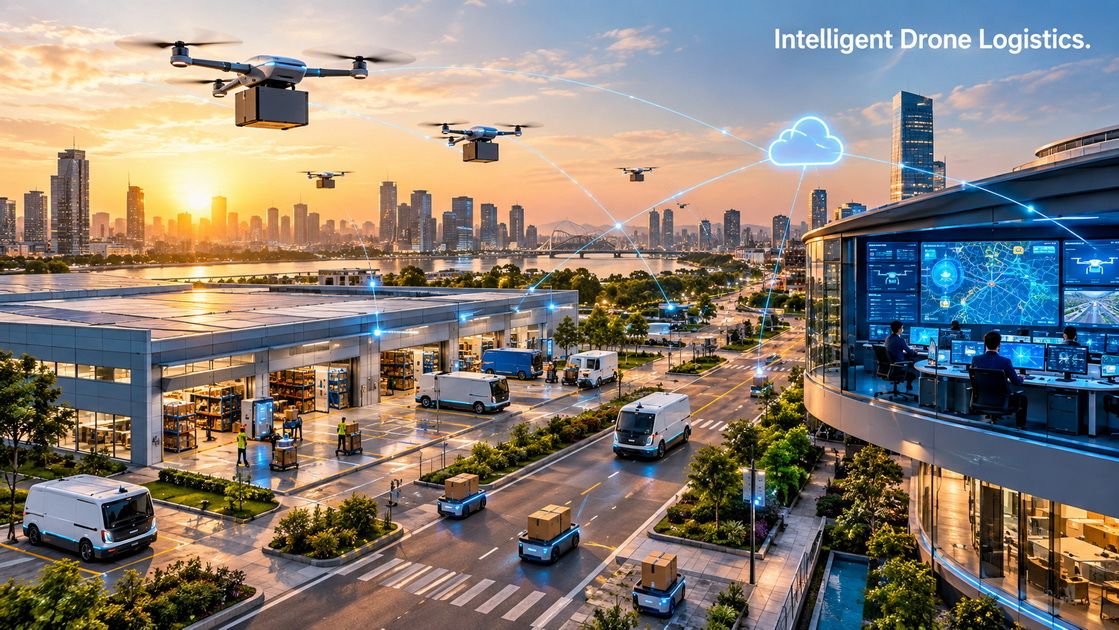
For Shenzhen Intelligent Drone Technology Co., Ltd. (SIDT), this industry transformation presents a meaningful opportunity. SIDT focuses on the deep integration and innovation of drone technology. The company delivers comprehensive, full-stack application solutions across low-altitude airspace, ground operations, and underground environments.
Through its independently developed intelligent flight platform, SIDT combines dynamic perception, precise data collection, intelligent analysis, and centralized cloud management. The goal is clear: transform advanced technology into practical productivity and create measurable value for customers in logistics, inspection, public safety, infrastructure management, and smart-city operations.
The most important question in commercial drone delivery is no longer whether a drone can carry a small parcel.
Modern delivery drones can already transport lightweight goods quickly across short urban and suburban routes. The more difficult challenge is building a dependable operational network that can function safely, efficiently, and repeatedly in real-world environments.
A large-scale drone delivery operation must coordinate many moving parts at the same time. These include order management, product availability, package preparation, route planning, aircraft condition, weather awareness, local airspace requirements, destination verification, customer notification, emergency handling, and data reporting.
This is why drone delivery should not be understood as a single aircraft completing a single flight. It should be viewed as a connected logistics system.
For consumers, drone delivery can make everyday life more convenient. A customer may need cold medicine late at night, a missing ingredient for dinner, pet food, baby supplies, household essentials, or a small repair part. These are often lightweight products, but they can be urgent.
For retailers and local service providers, drone delivery can create a faster option for selected orders. Instead of relying only on road-based couriers, companies can use low-altitude routes for eligible products and destinations.
For cities and industrial parks, drone delivery can become part of a broader intelligent transportation ecosystem. It can work alongside delivery vehicles, ground robots, warehouses, service stations, and human personnel.
The future is not about replacing every delivery method with drones. It is about creating a smarter division of labor between air, ground, underground, and human-operated resources.
The rapid development of commercial drone delivery provides several important lessons for retailers, urban planners, drone operators, industrial organizations, and public-safety departments.
Retail stores, warehouses, industrial parks, hospitals, emergency stations, transportation hubs, and community service centers can become local drone operation nodes.
Instead of building a completely new logistics system from the beginning, organizations can use existing facilities as launch points, storage points, charging locations, receiving stations, and dispatch centers.
This model creates several advantages:
| Operational Area | Benefit of Using Existing Facilities |
|---|---|
| Inventory | Products are already stored near customers or job sites |
| Delivery distance | Shorter routes improve response speed |
| Network expansion | Additional facilities can become service nodes over time |
| Equipment deployment | Charging stations and landing systems can be installed at key sites |
| Data integration | Existing inventory, security, and dispatch systems can connect to one platform |
| Operational control | Managers can monitor assets from a central command environment |
A retail store can act as a neighborhood fulfillment center. An industrial facility can operate as a spare-parts dispatch point. A public-safety station can become an emergency-drone launch base.
The physical location is not only a building. It becomes part of an intelligent operational network.
Drone delivery is especially useful when speed matters more than shipment size.
The ideal delivery mission is usually lightweight, time-sensitive, easy to package, and located within a predictable service radius. Examples include:
- Fresh food and small grocery items
- Medicine and health-related products
- Baby-care supplies
- Pet food
- Household essentials
- Emergency repair tools
- Spare parts for industrial maintenance
- Documents and small business materials
- Safety equipment
- Laboratory or inspection supplies
A large shipment of bulk products may still be better served by a truck or van. However, a small but urgent item can have a much higher value when delivered within minutes.
For example, a manufacturing site may need a replacement sensor, electrical connector, maintenance tool, or testing component before production can continue. In this situation, a fast delivery mission may reduce downtime and prevent operational disruption.
This is where drone delivery becomes more than a convenience service. It becomes a productivity tool.
A successful drone mission depends on a complete operational workflow.
The drone is visible. The intelligent system behind it is what makes the mission repeatable.
A typical delivery workflow includes:
1. The customer or business user submits an order
2. The system confirms product availability
3. Staff or automated equipment prepares the package
4. The platform checks route conditions and mission parameters
5. The drone receives a delivery assignment
6. The aircraft completes the low-altitude flight
7. The package is delivered to a verified destination
8. The system records mission data and operational status
9. Managers review performance and handle any exceptions
Every stage generates data. That data can be used to improve future operations.
A connected platform can help teams understand how long each mission takes, where delays occur, how weather affects performance, which routes are most efficient, which products are most frequently ordered, and where new launch nodes may be needed.

SIDT's "one-network coverage" model is designed to overcome the limitations of single-scenario drone deployment.
Traditional drone operations often focus on one aircraft, one task, one location, and one isolated data stream. This approach can work for simple demonstrations or individual inspection flights, but it becomes difficult to manage when an organization operates multiple drones, multiple facilities, multiple mission types, and multiple teams.
SIDT provides a broader approach.
Its intelligent cloud-control platform can connect low-altitude drones, ground devices, underground inspection equipment, sensors, personnel, and operational data within one coordinated management system.
This creates a unified operating environment for command, dispatch, monitoring, data analysis, and cross-team collaboration.
Low-altitude airspace has become an important new operational environment for commercial and public-service organizations.
Drones can support a wide range of missions, including:
- Lightweight package delivery
- Site inspection
- Facility patrol
- Infrastructure monitoring
- Emergency reconnaissance
- Environmental observation
- Construction progress tracking
- Perimeter security
- Temporary communication support
- Traffic and crowd monitoring
A centralized intelligent platform can help operators manage complex low-altitude missions through real-time aircraft tracking, route planning, geofencing, equipment monitoring, video transmission, mission scheduling, and exception alerts.
This allows organizations to move from isolated drone flights to structured, repeatable operational services.
For urban logistics, the platform can support flexible delivery scheduling. It can consider package weight, urgency, distance, weather conditions, destination type, battery capacity, aircraft availability, and local operational requirements before assigning a mission.
This creates a more efficient delivery model than manually coordinating every flight.
Although drones operate in the air, many of their most important processes happen on the ground.
Packages must be prepared. Aircraft must be loaded, launched, received, inspected, charged, and maintained. Ground personnel must manage exceptions. Smart stations, robots, vehicles, and sensors must work together.
SIDT can integrate aerial systems with ground-based assets such as:
- Unmanned ground vehicles
- Automated charging stations
- Smart drone ports
- Mobile command vehicles
- Warehouse equipment
- Security systems
- IoT sensors
- Dispatch terminals
- Video surveillance systems
- Environmental monitoring equipment
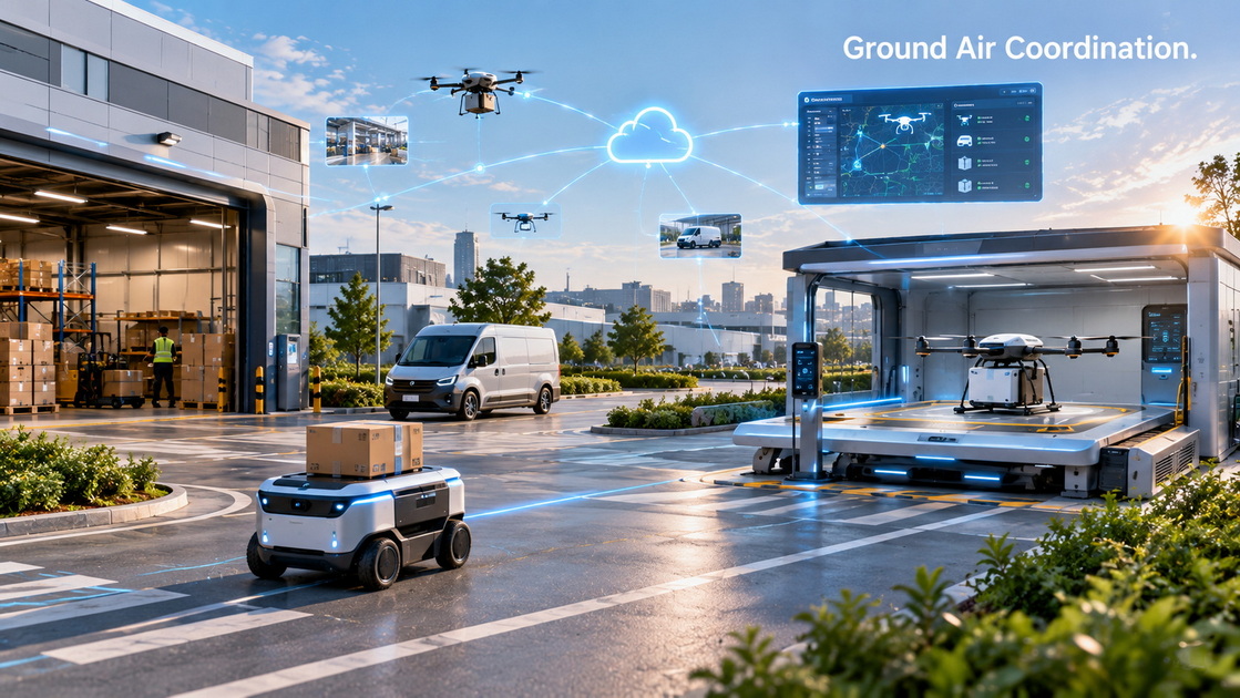
This creates a ground-air collaborative model.
For example, a package may move from a warehouse shelf to a ground robot. The robot transports it to a drone-loading station. The drone completes the local delivery flight. A receiving station or ground robot handles the final handoff. The cloud platform monitors the entire process.
The result is not simply drone delivery. It is an integrated automated logistics workflow.
Underground spaces are often difficult to inspect and manage.
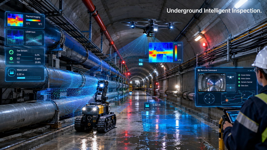
Tunnels, utility corridors, parking structures, basements, mines, underground commercial spaces, drainage systems, and pipeline networks can contain safety risks that are not easily visible from the surface.
Manual inspection can be slow, expensive, and dangerous. Workers may face confined spaces, poor visibility, water accumulation, gas hazards, unstable structures, or communication limitations.
SIDT's underground-space detection solutions can combine drones, inspection robots, environmental sensors, visual systems, and intelligent analytics to collect operational data in difficult environments.
These systems can help identify:
- Water accumulation
- Gas leaks
- Smoke or fire indicators
- Structural damage
- Cracks and deformation
- Equipment failure
- Blocked passages
- Unauthorized access
- Communication blind spots
- Environmental abnormalities
- Potential safety hazards
When underground inspection data is connected to an above-ground command platform, managers can gain a more complete view of facility conditions and emergency situations.
This is particularly valuable during flooding, fire incidents, utility failures, industrial accidents, and search-and-rescue operations.
The future of urban delivery will depend on coordinated transportation rather than a single delivery method.
An urban airspace 3+1 delivery network can combine several modes of service into one operational framework. These may include drones, ground robots, delivery vehicles, and human-assisted delivery teams.
Each resource has a different strength.
| Delivery Resource | Best-Fit Scenario | Main Advantage |
|---|---|---|
| Delivery drone | Small, urgent, lightweight deliveries | High speed for short local routes |
| Ground robot | Campuses, communities, industrial parks, closed areas | Efficient low-speed autonomous delivery |
| Delivery vehicle | Large, heavy, multi-order shipments | High payload capacity and route flexibility |
| Human delivery staff | Complex destinations and customer-service needs | Flexible judgment and secure handoff capability |
A unified cloud-control platform can select the most appropriate delivery method for each mission.
For instance, a small package of medicine within a local service area may be suitable for drone delivery. A larger grocery order may be assigned to a delivery vehicle. A parcel for an office park may be delivered by drone to a receiving station and transferred to a ground robot. A delivery requiring identity verification may involve a human service representative.
This approach improves reliability because not every order is treated in the same way.
An intelligent dispatch platform can use operational data to make better decisions.
The system can assess:
- Package size and weight
- Order urgency
- Distance to destination
- Aircraft availability
- Battery capacity
- Weather conditions
- Airspace conditions
- Ground congestion
- Delivery-point accessibility
- Customer receiving requirements
- Equipment maintenance status
- Emergency mission priority
This allows the platform to assign resources based on real conditions rather than fixed assumptions.
For example, if a strong wind condition makes drone operation unsuitable, the system can reassign the order to a ground vehicle or ground robot. If an urgent emergency-supply mission appears, the system can prioritize the most suitable aircraft and delay a lower-priority commercial delivery.
This capability is essential for maintaining service quality in real-world environments.
The expansion of low-altitude operations depends on safety, reliability, and public confidence.
Beyond visual line of sight operations are especially important because they allow qualified drones to travel beyond the direct visual observation range of the pilot. This capability can expand service coverage and improve operational efficiency.
However, broader operations also require stronger technical and management systems.
A safe low-altitude operation should include:
- Reliable command-and-control communication
- Accurate positioning and navigation
- Dynamic route planning
- Airspace-awareness capability
- Obstacle detection and avoidance
- Real-time aircraft health monitoring
- Battery and power management
- Emergency landing procedures
- Clear operational permissions
- Maintenance records
- Mission logs and playback
- Data security and access control
- Staff training and emergency procedures
A centralized cloud platform gives operators a clearer view of the entire operation.
Instead of relying on separate dashboards for each aircraft or location, managers can monitor multiple missions from one command environment. They can identify abnormal conditions quickly, coordinate field teams, adjust mission schedules, and maintain a complete record of operational activity.
This is especially important in dense urban areas, industrial parks, transportation hubs, and emergency-response environments.
Drone technology creates the greatest value when it improves decisions, not simply when it captures images or completes flights.
Every mission can generate useful operational information. A drone may collect visual data, thermal data, LiDAR scans, environmental readings, location data, equipment status, route information, delivery confirmations, and incident records.
The key challenge is turning that information into practical action.
SIDT's full-stack solutions are designed to support four connected operational layers.
Drones, ground devices, underground inspection systems, and sensors collect data from complex environments.
This may include:
- High-definition images
- Thermal imagery
- Video streams
- Environmental measurements
- Gas detection data
- Structural inspection data
- Location information
- Equipment status
- Delivery confirmation data
- Route and time records
Accurate data collection gives organizations a stronger foundation for monitoring assets and understanding operational conditions.
Dynamic perception means identifying what is happening in real time.
The platform can help detect conditions such as:
- A delivery delay
- An abnormal aircraft condition
- A route obstruction
- A low battery warning
- A safety incident
- A damaged infrastructure component
- A water accumulation event
- A fire risk
- A security intrusion
- A communication interruption
Early detection helps managers respond before a small issue becomes a major disruption.
Intelligent analysis helps operators understand what the data means.
Instead of reviewing every video clip or inspection image manually, teams can use analytical tools to identify anomalies, compare current conditions with historical records, prioritize urgent issues, and support faster decision-making.
For example, an inspection system may identify a growing crack in a tunnel wall. A maintenance manager can review the information, compare it with prior inspection results, assign a field team, and track the repair process through the same platform.
The final layer is coordinated action.
A unified command platform can assign tasks, monitor progress, share information across departments, and maintain records for management review.
This is particularly valuable when multiple teams must work together. During an emergency, aerial drones may provide a broad overview, ground teams may investigate access routes, underground systems may inspect tunnels or utility corridors, and command-center personnel may coordinate resources.
One connected network helps all participants work from the same operational picture.
Intelligent inspection is one of the most practical applications of drone technology.
Factories, power facilities, rail corridors, bridges, construction sites, pipelines, warehouses, ports, solar farms, and industrial parks all require regular inspection. In many cases, manual inspection is time-consuming, labor-intensive, or potentially dangerous.
Drones can improve inspection workflows by reaching elevated, remote, or hazardous areas more quickly.
Potential benefits include:
- Faster inspection cycles
- Reduced work at height
- Improved worker safety
- More consistent data collection
- Earlier fault detection
- Better maintenance planning
- Stronger visual documentation
- Reduced unplanned downtime
- Improved asset management
The value increases when inspection data is linked to a cloud platform. Managers can compare data across time, identify recurring issues, prioritize maintenance tasks, and create more accurate records for asset management.
For industrial users, the goal is not simply to use a drone. The goal is to reduce risk, improve maintenance decisions, and protect production continuity.
Emergency response requires speed, visibility, and coordination.
During a fire, flood, industrial accident, utility failure, traffic incident, or search-and-rescue operation, decision-makers need accurate information as quickly as possible.
Aerial drones can provide immediate situational awareness from above. They can capture video, thermal imagery, map affected areas, identify blocked routes, locate people, and support communication between field teams and command centers.
Ground devices and personnel can provide closer inspection, material transport, perimeter control, and on-site response. Underground inspection platforms can check tunnels, drainage systems, pipelines, basements, and utility corridors.
SIDT's unified platform can connect these resources into one operational network.
A coordinated emergency-response workflow may include:
1. A command center receives an incident alert
2. A drone conducts rapid aerial reconnaissance
3. The platform transmits live images and location data
4. Ground teams receive route and hazard information
5. Underground devices inspect affected infrastructure if necessary
6. The system records mission data and updates the operational picture
7. Managers allocate additional resources based on real-time conditions
This integrated model can help reduce response time, improve team coordination, and support safer decision-making during complex incidents.
The future of drone operations will be defined by integration.
A drone alone cannot create a city-wide delivery system. A camera alone cannot create intelligent inspection. A sensor alone cannot manage underground risk. A command center alone cannot respond effectively without live field information.
The strongest solutions connect all of these elements.
SIDT is committed to building comprehensive, full-stack application solutions for low-altitude airspace, ground environments, and underground spaces. Through intelligent flight platforms, dynamic perception, precise data collection, intelligent analysis, and unified cloud control, the company helps customers connect equipment, people, data, and decisions.
This approach supports a wide range of real-world applications:
- Intelligent inspection
- Underground-space detection
- Urban airspace 3+1 delivery
- Ground-air coordinated emergency response
- Industrial park management
- Infrastructure monitoring
- Smart logistics
- Public-safety operations
- Environmental monitoring
- Digital city development
As drone technology becomes more deeply integrated into cities, industry, and public services, the focus will shift from individual devices to connected ecosystems.
A unified network can make drone operations safer, more efficient, more visible, and more valuable.
SIDT helps organizations build the intelligent operational foundation needed for the next generation of low-altitude, ground, and underground applications.
Urban airspace 3+1 delivery is an integrated delivery model that combines drones, ground robots, delivery vehicles, and human-assisted services. A unified management system selects the best resource for each delivery based on package size, urgency, distance, route conditions, and destination requirements.
Drone delivery is best suited for lightweight, urgent, and easily packaged products. Common examples include medicine, groceries, baby supplies, pet food, household essentials, small spare parts, safety equipment, documents, and repair tools.
A cloud-control platform helps operators manage multiple drones, locations, missions, devices, and teams from one interface. It can support route planning, real-time monitoring, mission scheduling, equipment management, data analysis, emergency alerts, and cross-team coordination.
Yes. Drones can inspect elevated, remote, large-scale, or potentially hazardous areas at factories, construction sites, energy facilities, bridges, rail corridors, pipelines, warehouses, and industrial parks. They can collect visual, thermal, and spatial data to support maintenance planning and safety management.
Drones can provide rapid aerial reconnaissance, live video, thermal imaging, mapping, search support, traffic observation, route assessment, and small-item delivery during emergencies. Their value increases when they are connected with ground teams, sensors, and centralized command platforms.
Underground space detection uses drones, robots, sensors, cameras, and analytical platforms to inspect tunnels, utility corridors, pipelines, parking facilities, mines, basements, and other underground environments. It can help identify hazards such as gas leaks, water accumulation, structural damage, equipment failures, and blocked passages.
"One-network coverage" means that low-altitude drones, ground equipment, underground inspection devices, sensors, and command centers are connected through one unified cloud-control platform. This enables centralized monitoring, command, dispatch, data sharing, analysis, and collaboration across multiple operational environments.


