Global Distributors Wanted
1.Free Cloud Service Deployment
2.Free Technical Training
3.Exclusive Territory Protection

1.Free Cloud Service Deployment
2.Free Technical Training
3.Exclusive Territory Protection


Views: 221 Author: Aaron Publish Time: 2026-10-03 Origin: Site


Content Menu
● Why Flood-Affected Supply Operations Need Multiple Transport Methods
● Drone Logistics for Flood Emergency Delivery
>> When Drone Logistics Is Most Effective
>> Key Advantages of Drone Logistics
>> Drone Logistics Limitations
● River Transport for Flood Relief Supply Operations
>> When River Transport Is Most Effective
>> Key Advantages of River Transport
>> River Transport Limitations
● Drone Logistics vs River Transport: Detailed Comparison
● A Ground-Air-Water Logistics Model for Flood Response
● How SIDT Supports Integrated Flood Supply Operations
>> Unified Flood Response Capabilities
>> Ground-Air Coordinated Emergency Response
● Expert Planning Guide: Choosing the Right Transport Method
>> Step 1: Classify the Supply Request
>> Step 2: Map Current Access Conditions
>> Step 3: Set Delivery Priorities
>> Step 4: Match the Transport Mode to the Mission
● Safety and Operational Readiness
>> River Transport Safety Essentials
● Cost and Scalability Considerations
>> 1. What is the main difference between drone logistics and river transport during floods?
>> 2. Can cargo drones deliver emergency medicines during a flood?
>> 3. Are boats more useful than drones for flood relief?
>> 4. What types of cargo should be transported by river during flood operations?
>> 5. Can drones operate in heavy rain and strong winds?
>> 6. How can drones improve river transport missions?
>> 7. What is a ground-air-water emergency logistics network?
>> 8. Why is a unified command platform important during flood operations?
Drone logistics and river transport play different but equally important roles in flood-affected supply operations. Drones are highly effective for lightweight, urgent, point-to-point deliveries across damaged roads and inaccessible terrain. River transport remains essential for moving large volumes of relief supplies, emergency personnel, rescue equipment, and heavy cargo through usable waterways.
The strongest flood-response model is not based on choosing one method over the other. It combines cargo drones, boats, ground vehicles, field teams, and a unified command platform into a coordinated operational network. This approach improves access, delivery speed, resource visibility, and safety when conventional transport routes fail.
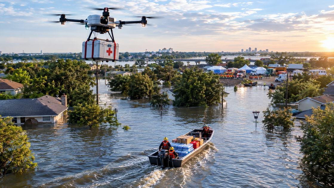
Floods create complex logistics failures. Roads may be submerged. Bridges may collapse. Power outages can affect communications. Warehouses may become inaccessible. Water levels can rise rapidly, changing a safe route into a dangerous one within a few hours.
In these situations, emergency teams cannot depend on a single transport method.
A truck may carry large quantities of food and water but cannot cross a washed-out bridge. A boat may move hundreds of kilograms of supplies but may not reach homes located uphill, inside narrow streets, or beyond debris-covered shorelines. A cargo drone can cross damaged terrain directly, but it cannot replace a boat for high-volume movement.
The right question is not, "Which transport method is better?"
The right question is:
Which method can safely deliver the right supplies, to the right location, at the right time?
For flood emergency logistics, planners must consider several factors:
- How urgent is the request?
- How much does the cargo weigh?
- How far is the destination from the staging area?
- Are roads, waterways, and landing zones safe?
- Can the cargo be divided into smaller loads?
- Does the shipment require temperature control?
- Are weather conditions suitable for drone or boat operations?
- Can personnel safely load and unload the cargo?
- Does the community need one urgent delivery or repeated resupply?
- Can the transport system provide reliable delivery confirmation?
A flexible logistics network gives emergency managers more choices when conditions change.
Drone logistics uses unmanned aircraft to carry supplies, collect field data, inspect damaged infrastructure, and support emergency teams. In flood environments, cargo drones can fly over destroyed roads, flooded fields, blocked bridges, unstable riverbanks, and debris-covered routes.
This direct route capability makes drones valuable during the early stage of an emergency, when access information is limited and communities may be isolated.

Drone logistics is most suitable for urgent, lightweight, high-value, and time-sensitive cargo.
Common drone delivery missions include:
- Emergency medicines and first-aid supplies
- Blood products and laboratory samples
- Water purification tablets and testing kits
- Satellite phones and handheld radios
- Radio batteries and portable chargers
- Compact food rations
- Infant formula and hygiene products
- Medical diagnostic equipment
- Emergency repair parts for pumps, sensors, or communication devices
- Small rescue tools and flotation equipment
A drone may deliver only a small payload compared with a boat, but that payload can be operationally critical.
For example, a small package containing antibiotics, insulin, blood, water filters, or communication batteries may protect lives and maintain response coordination. In these missions, the value of the delivery is not defined by weight. It is defined by urgency and impact.
Drone logistics can provide several important benefits in flood-affected areas.
- Direct access across damaged infrastructure
Drones can fly over flooded roads, collapsed bridges, landslides, and debris fields.
- Rapid point-to-point delivery
A drone can take a direct route between a staging area and an isolated destination.
- Reduced responder exposure
Drone delivery can reduce the need for personnel to enter contaminated water, unstable terrain, or dangerous flood zones.
- Fast operational assessment
Inspection drones can identify damaged roads, blocked waterways, stranded residents, and suitable delivery points.
- Digital delivery records
Flight paths, timestamps, payload status, GPS data, video records, and delivery confirmation can create a traceable mission record.
- Flexible deployment
Drones can operate from mobile command vehicles, emergency warehouses, hospitals, temporary landing zones, and riverside staging points.
Drone logistics is not designed for every relief mission.
Its limitations include:
- Restricted payload capacity
- Limited battery endurance
- Sensitivity to strong wind, heavy rain, lightning, and poor visibility
- Need for safe launch and delivery areas
- Requirement for trained operators and maintenance teams
- Need for reliable command, communication, and tracking systems
- Potential airspace restrictions
- Limited suitability for large-scale food, water, fuel, and shelter distribution
A drone should not be assigned to carry cargo that a boat can move more efficiently. Drone capacity should be reserved for missions where speed, direct access, and urgency create a clear advantage.
River transport includes boats, rescue vessels, landing craft, shallow-draft boats, ferries, barges, and other waterborne assets used to move people and cargo across navigable waterways.
During major floods, water can create a temporary transport corridor. Roads may be unusable, but rivers, canals, flooded lowlands, and coastal channels may support boat-based movement.
River transport is especially valuable when emergency operations require repeated delivery of large volumes of supplies.
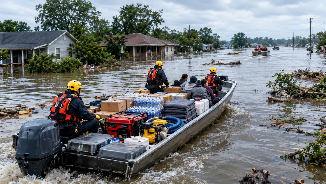
River transport is usually the better choice for bulk cargo, personnel movement, evacuation, and repeated supply delivery.
Typical waterborne missions include:
- Transporting bottled water and food cartons
- Delivering shelter kits, blankets, and sanitation supplies
- Moving generators, pumps, fuel, and tools
- Carrying medical teams and emergency responders
- Evacuating residents from flooded communities
- Supporting floating medical units
- Transporting water treatment equipment
- Moving communications equipment and temporary power systems
- Establishing supply routes between staging hubs and river communities
- Supporting rescue operations in inaccessible areas
A boat can move supplies that would require many drone flights. This makes river transport far more efficient for heavy and high-volume cargo.
River transport offers several important strengths during flood operations.
- High cargo capacity
Boats and barges can carry much larger loads than cargo drones.
- Personnel transport capability
River vessels can move rescuers, doctors, engineers, logistics teams, and evacuees.
- Repeated supply routes
A boat can complete multiple distribution runs between a staging area and affected communities.
- Support for large emergency equipment
Waterborne transport can carry generators, fuel containers, pumps, water tanks, and construction tools.
- Mobile distribution capability
Boats can function as moving supply platforms or temporary distribution points.
- Access to water-based communities
River transport is highly practical in delta regions, coastal zones, floodplains, canals, and river settlements.
River transport can also face major operational barriers.
- Strong currents can make navigation dangerous
- Floating debris may damage vessels or propellers
- Water depth may change rapidly
- Submerged buildings, vehicles, fences, and power lines can create hazards
- Floodwater may be contaminated
- Safe loading and unloading points may be limited
- Docking areas may be damaged or underwater
- Bad weather can stop or delay missions
- Trained boat crews and water-rescue equipment are required
- Some communities remain difficult to reach from the shoreline
A boat may reach a village but still be unable to deliver supplies directly to a clinic, school shelter, or household located beyond a damaged waterfront access point. This is where drone logistics can become the final connection.
| Factor | Drone Logistics | River Transport |
|---|---|---|
| Primary purpose | Rapid delivery of urgent, lightweight cargo | Bulk transportation of supplies, equipment, and people |
| Best cargo type | Medical supplies, radios, batteries, water filters, compact food, urgent spare parts | Food cartons, bottled water, shelter kits, generators, pumps, fuel, personnel |
| Payload capacity | Limited by drone type and mission range | High, depending on vessel type and loading conditions |
| Delivery speed | Fast for direct point-to-point missions | Efficient for large loads but affected by loading, current, route conditions, and docking |
| Terrain access | Can cross flooded roads, damaged bridges, and debris zones | Requires navigable water routes and safe landing points |
| Final-mile access | Strong for isolated homes, clinics, and small shelters | Limited when shore access is blocked or unsafe |
| Bulk supply efficiency | Low for heavy-volume distribution | High for repeated large-scale supply movement |
| Personnel exposure | Can reduce field-team exposure in hazardous zones | Requires skilled crew and may expose teams to water hazards |
| Data collection | Strong for aerial mapping, imaging, route checks, and assessment | Useful for local observation but limited in aerial coverage |
| Infrastructure needs | Launch zone, recovery zone, charging, communications, operators | Water access, fuel, trained crew, loading area, safety gear, navigation support |
| Weather sensitivity | Sensitive to wind, heavy rain, lightning, and visibility | Sensitive to currents, debris, weather, and water level |
| Best role in a larger network | Emergency aerial bridge and last-mile connector | Main supply corridor and personnel transport asset |
The most important conclusion is simple:
Boats move volume. Drones solve urgent access problems.
A well-designed flood logistics system should connect transport modes instead of using them separately.
This creates a ground-air-water logistics model.
The ground layer includes warehouses, emergency stockpiles, medical centers, command vehicles, trucks, and local distribution points.
The water layer includes boats, rescue vessels, barges, temporary docks, landing craft, floating warehouses, and waterborne medical teams.
The low-altitude layer includes cargo drones, mapping drones, inspection drones, communication relay drones, and intelligent flight systems.
Together, these layers create a connected response network.
A typical coordinated flood delivery operation may follow this process:
1. Ground vehicles move supplies from a warehouse to a riverside staging point.
2. Boat crews transport bulk supplies through a navigable river or flood corridor.
3. Aerial drones inspect the route and identify isolated communities, damaged bridges, blocked roads, and safe delivery locations.
4. Boats deliver food, water, shelter kits, and equipment to a community distribution point.
5. Cargo drones transport urgent medical items, communication equipment, or lightweight supplies to destinations beyond the boat's safe access range.
6. A unified command platform records inventory movement, flight data, boat location, field reports, weather conditions, and proof of delivery.
7. Emergency managers adjust the next mission according to demand, route safety, weather, and resource availability.
This structure improves response flexibility. It prevents teams from wasting drone capacity on bulk cargo while ensuring that urgent small deliveries do not wait for the next boat mission.
Shenzhen Intelligent Drone Technology Co. Ltd. focuses on the deep integration of drone technology across low-altitude, ground, and underground environments. For flood response, this approach supports an operational system that connects aircraft, personnel, vessels, sensors, ground equipment, data platforms, and emergency command centers.
SIDT's one-network coverage approach is designed to reduce fragmentation between different operational tools.
Rather than managing drones, boats, ground vehicles, and response teams through separate systems, emergency organizations can coordinate resources through one intelligent cloud control platform.
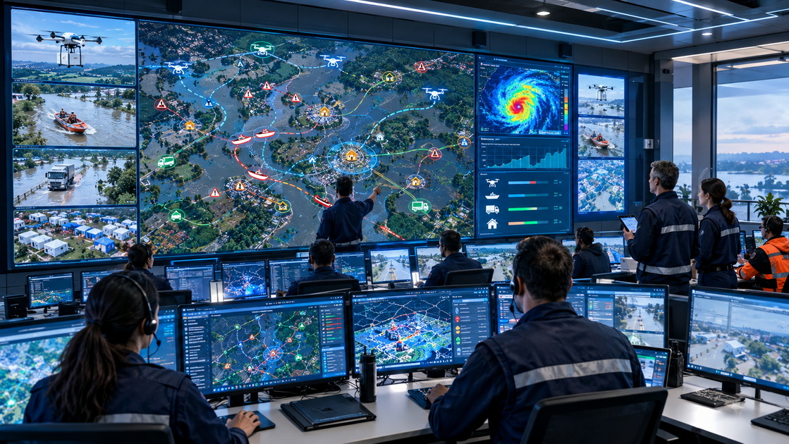
An integrated system can support:
- Intelligent drone dispatch
- Real-time flight monitoring
- Payload and mission tracking
- Dynamic route planning
- Boat and vehicle position monitoring
- Weather alerts and risk notifications
- Flood-area mapping
- Infrastructure inspection
- Emergency demand prioritization
- Multi-node equipment scheduling
- Video and data collection
- Mission records and delivery verification
- Coordination between government, medical, rescue, and logistics teams
This is important because flood-response decisions are dynamic.
A river route may become unsafe because of debris. A shelter may suddenly need medical supplies. A damaged road may reopen temporarily. A community may lose communication with the command center. An intelligent platform helps teams update plans rapidly and direct the most suitable resource to each mission.
Ground-air coordination becomes especially valuable when flood conditions create fragmented access.
For example, an emergency team may use a drone to inspect a damaged bridge before sending a boat crew into the area. The same drone can identify a safe delivery zone, guide responders toward stranded residents, and later transport medical supplies to a remote clinic.
This connected workflow improves:
- Situational awareness
- Resource allocation
- Responder safety
- Delivery speed
- Operational transparency
- Mission accountability
- Community coverage
The result is a more practical and scalable flood-response system.
Emergency planners should begin with the mission requirement, not the available vehicle.
First, determine what must be delivered.
Ask the following questions:
- Is the item life-critical?
- How much does it weigh?
- Does it require temperature control?
- Can it be divided into smaller packages?
- Does it need to arrive within minutes, hours, or days?
- Is the destination accessible by water?
- Can the recipient safely receive the item?
- Does the cargo require a human team for installation or use?
A small emergency medicine package may require a drone. A generator requires a boat, truck, or heavy-lift aircraft. A medical team may require a boat, even if medical supplies can arrive first by drone.
Build an updated operational map that includes:
- Flooded roads
- Damaged bridges
- Navigable waterways
- Strong-current areas
- Debris fields
- Safe loading points
- Boat landing locations
- Drone launch and recovery sites
- Shelters and medical facilities
- Isolated communities
- Weather conditions
- Communications coverage
- Restricted airspace and hazardous zones
Mapping should be continuously updated because flood conditions can change rapidly.
A practical classification system can help allocate limited resources.
| Priority | Mission Type | Examples | Preferred Transport Method |
|---|---|---|---|
| P1 | Life-critical delivery | Blood, emergency medicine, rescue communications, urgent medical samples | Cargo drone or helicopter |
| P2 | Time-sensitive support | Water filters, infant supplies, batteries, diagnostic kits | Drone, fast boat, or combined delivery |
| P3 | Essential replenishment | Food, hygiene kits, blankets, drinking water | Boat, truck, or coordinated boat-drone system |
| P4 | Bulk recovery supply | Pumps, generators, fuel, heavy equipment, building materials | Barge, landing craft, truck, or heavy-lift aircraft |
This structure helps emergency teams reserve drone capacity for the missions where speed matters most.
Use drones when the mission requires:
- Direct access across damaged terrain
- Lightweight urgent cargo
- Fast delivery to isolated destinations
- Aerial inspection or route assessment
- Reduced responder exposure
- Communication support
Use river transport when the mission requires:
- High-volume cargo movement
- Personnel transport
- Evacuation operations
- Delivery of heavy equipment
- Repeated supply routes
- A floating distribution platform
Use a combined model when:
- Bulk cargo can reach the community by boat
- Urgent items must continue beyond the river landing point
- Aerial assessment is needed before boat deployment
- Ground, water, and air routes must be coordinated in real time
Flood logistics should never depend on speed alone. Operational safety must guide every mission.
Drone teams should prepare:
- Weather monitoring systems
- Backup batteries and charging solutions
- Payload securing procedures
- Predefined emergency landing zones
- Reliable command and communication links
- Trained pilots and visual observers
- Safe launch and recovery areas
- Maintenance and inspection checklists
- Community notification procedures
- Flight route risk assessments
Boat crews should prepare:
- Personal flotation devices
- Water-rescue equipment
- Navigation lights and communications devices
- Fuel reserves
- Secure cargo restraints
- Crew rotation plans
- Route reconnaissance procedures
- Emergency medical supplies
- Floodwater contamination protection
- Safe loading and unloading protocols
- Clear rescue and evacuation procedures
A flood response operation is only successful if responders, cargo recipients, and local communities remain protected throughout the mission.
Cost should be measured by more than vehicle price. Emergency teams should evaluate the complete cost of successful delivery.
Drone logistics requires investment in aircraft, batteries, charging systems, payload containers, operators, maintenance, communication systems, field deployment equipment, and mission management tools.
River transport requires boats, fuel, trained crews, navigation equipment, safety gear, loading teams, docking locations, maintenance support, and possible standby time caused by severe weather or unsafe waterways.
| Cost Factor | Drone Logistics | River Transport |
|---|---|---|
| Equipment investment | Moderate to high, depending on payload, range, and autonomy | Moderate to high, depending on vessel size and operating environment |
| Best cost use | Urgent and lightweight delivery missions | Bulk cargo and repeated supply runs |
| Cost per kilogram | Higher for large cargo volumes | Usually lower for heavy and high-volume cargo |
| Personnel needs | Smaller field team with trained drone operators | Larger team including boat crew, loaders, and safety support |
| Deployment speed | Fast if equipment and launch sites are prepared | Fast when boats, crew, fuel, and access points are available |
| Large-scale expansion | Requires more aircraft, pilots, batteries, and traffic coordination | Requires more vessels, crews, fuel, docking capacity, and maintenance support |
The best financial model often combines both methods. Boats reduce the cost of moving large cargo. Drones reduce the cost of delayed access when a small urgent item cannot wait.
Drone logistics and river transport are both essential for flood-affected supply operations, but they solve different problems.
River transport provides the capacity needed for bulk relief distribution, personnel movement, evacuation, and heavy equipment delivery. Drone logistics provides the speed and direct access needed for urgent, lightweight, and last-mile missions.
The most resilient flood logistics strategy is a coordinated ground-air-water system. It uses each transport method where it delivers the greatest operational value.
For emergency organizations, municipalities, humanitarian teams, medical networks, and industrial operators, the key is to prepare before the flood occurs. Map routes. Identify staging areas. Test drone corridors. Build water transport capacity. Package critical supplies. Train teams. Establish data-sharing procedures. Connect all response resources through one intelligent command platform.
SIDT's one-network approach helps organizations coordinate drone operations, ground resources, sensing systems, emergency equipment, and multi-node response teams through a unified operational environment.
Create a flood-response logistics network that moves essential supplies by air, water, and ground while giving command teams the visibility needed to act quickly and safely.
Drone logistics is designed for urgent, lightweight, direct delivery across inaccessible terrain. River transport is designed for high-volume cargo movement, personnel transport, evacuation, and repeated supply delivery along navigable waterways.
Yes. Cargo drones can deliver emergency medicines, diagnostic equipment, water purification tablets, batteries, radios, compact food, and other lightweight supplies to isolated clinics, shelters, and communities when roads or bridges are damaged.
Boats are more useful for moving heavy cargo, large supply volumes, rescue teams, and evacuees. Drones are more useful for urgent, lightweight, and hard-to-reach deliveries. Both systems are most effective when used together.
River transport is suitable for bottled water, food cartons, shelter kits, blankets, generators, fuel, pumps, medical teams, rescue equipment, sanitation supplies, and other heavy or high-volume cargo.
Drone operations depend on the aircraft's approved weather limits, payload, wind speed, rainfall intensity, visibility, and local operational requirements. Teams should only launch when conditions remain within safe operating parameters.
Drones can inspect waterways, identify debris, assess flooded roads, locate stranded residents, verify landing points, monitor boat routes, and deliver urgent supplies beyond the boat's final access point.
It is an integrated logistics system that connects warehouses and trucks on the ground, boats and barges on waterways, and drones in low-altitude airspace. A unified platform coordinates routes, equipment, cargo, personnel, weather information, and delivery data.
A unified platform helps emergency teams monitor drone status, vessel locations, supply movement, weather conditions, flood zones, delivery priorities, and field reports in one place. This improves decision-making, coordination, accountability, and response speed.
1. World Food Programme. "." This report describes the use of humanitarian cargo drones to support communities isolated by flood-damaged roads and bridges.
2. Federal Emergency Management Agency. "." This guide covers emergency distribution planning, transportation coordination, resource staging, inventory management, and supply-chain resilience.
3. Federal Emergency Management Agency. "." This resource outlines operational requirements and capabilities for search, rescue, and recovery in swiftwater and flood environments.
4. World Food Programme. "." This overview explains how drone systems can support disaster assessment, emergency response, logistics, communications, and humanitarian operations.
5. Federal Emergency Management Agency. "." This framework identifies transportation and communications as key functions in disaster response coordination.
6. Li, et al. "." *Journal of Flood Risk Management*. This research examines coordinated emergency material distribution using trucks, speedboats, and drones.
7. International Federation of Red Cross and Red Crescent Societies. "." This framework addresses coordinated emergency operations, transport, fleet management, supply planning, warehousing, and humanitarian logistics.


